Harwood Wanderings

20201011_121021 sml

Old sheep stell (fold) and view south towards Mount Gilbert (c) Duncan Hutt

A day out exploring parts of Harwood Forest in Northumberland turned up a few interesting pieces of archaeology though the wildlife was a little more lacking.

The remains of an old mediaeval cross was an intriguing feature on the Ordnance Survey map. Manside Cross comprises a socket stone and the base of a cross.  On two sides there are much later carved letters.  On one side an H, presumably indicating Harwood: on the one 90degrees around, I D. What this stands for seems unclear as the stone is on the boundary of Harwood and Elsdon.  The ancient monument citations don’t help as they indicate a carved letter on one side only! Next to the cross are some striking iron age earthworks.

This forest is relatively new and the remains of old field boundaries as well as sheep stells (folds) are dotted amongst the trees.  These stells, circular walled structures, are scattered throughout the uplands, places to gather the sheep from the moorland.  They are redundant now and most are in decay, this one is now in the open but Sitka spruce has been felled and replanted around so in time this will be marooned back in the forest.

20201011_131342 crop

Manside Cross (c) Duncan Hutt

Posted in Archaeology, Northumberland | Tagged , , , , , | Leave a comment

Footprints in the Sand

OLYMPUS DIGITAL CAMERA

The high tide line (c) Duncan Hutt

For some reason it’s been a while since we spent time on a Northumberland beach, and there are some great stretches of sand on offer around the county.  The section south of Alnmouth – referred to as Buston Links on the map – is a quiet section of coast with dunes piled high behind a sandy shoreline.  The tide was just on the turn leaving a clearly defined line between wet and dry beach.  So well defined that the intricacies of the boundary provided patterns reminiscent of country coastlines.

OLYMPUS DIGITAL CAMERA

Unknown footprints in the sand (c) Duncan Hutt

OLYMPUS DIGITAL CAMERA

Feeding frenzy around a dessicated plant (c) Duncan Hutt

A few birds waited along the tideline and other smaller birds hunted out seeds on the dune front, a lack of binoculars meant that they remain unidentified this time.  On that dune front where the first shoreline plants make a living, before the marram grass covered sand of the dunes themselves, there were rich pickings to be had, seeds on the desiccated sand-spurrey or insects in little heaps of beached seaweed.  The birds flew off but their footprints remained in the dry sand.

The sun never quite appeared but provided a stormy looking backdrop to the beach exploration.  To the south Amble and the mouth of the River Coquet, out to sea and barely discernible as it sat low to the waves was Coquet Island with its stubby lighthouse.

OLYMPUS DIGITAL CAMERA

A view south towards Amble and Coquet Island (c) Duncan Hutt

Posted in Birds, Northumberland | Tagged , , | 2 Comments

Showers over Bute

IMG_8369 St Ninian's Bay

St Ninian’s Bay, Bute (c) Duncan Hutt

Autumn is a relatively quiet time of year, the summer is over and winter’s arrival is imminent.  It’s a time of closing down, a time to see the last few butterflies on warm calm days and also a time to welcome winter arrivals, birds from further north or birds on the shore that spent the summer in the hills.

OLYMPUS DIGITAL CAMERA

Turnstones in Millport, Great Cumbrae (c) Duncan Hutt

So it was on Bute that we caught a late small copper hunkered down in the vegetation and a red admiral in a sheltered quarry around over ripe and now somewhat tasteless blackberries.  On the shore things were quiet with the tide well in leaving little feeding for the curlew and turnstone that clung onto rocks around Bute and its neighbour Great Cumbrae. Plants too put on a last splash of colour, second flowerings of many such as bird’s-foot trefoil and the last signs of blue devil’s bit scabious.

IMG_8429 curlew cumbrae

Curlew on Gt Cumbrae (c) Duncan Hutt

The first day was clear and bright as Bute nestled in the Firth of Clyde.  Rain came overnight but the skies cleared as we made our way via the mainland over to Great Cumbrae.  Showers swept up from Arran over Bute and towards Dunoon but passed us by, rainbows following.  The Bute ferry plying back and forth to Rothesay was dwarfed by the colourful displays overhead. Two islands visited over a couple of days, part of a 50 islands challenge.  More on those two islands can be found on our 50 Islands blog: Bute and Great Cumbrae

IMG_8457 raibows out at sea

Showers pass between Bute and Great Cumbrae (c) Duncan Hutt


Posted in Birds, Flowering Plants, Scotland | Tagged , , , , | 1 Comment

North Walney

IMG_7737 heath and hills

Coastal heath and the Furness hills beyond (c) Duncan Hutt

IMG_7726 iron birds

Metal birds on a gate (c) Duncan Hutt

The approach through suburban streets and a potholed road that seems about to drop onto the beach is not the most promising but beyond the shingle parking and the security fenced airfield is a different world.  North Walney National Nature Reserve starts with a sign and a metal gate on which are perched tens of camouflaged metal birds.

OLYMPUS DIGITAL CAMERA

An almost white common spotted orchid or close hybrid (c) Duncan Hutt

The path leads through heather covered dunes dotted with yellow hawkweeds and cat’s-ears.  Eventually it enters damp meadows strewn with orchid spikes, mostly common spotted and hybrids with northern marsh which still lingered in places.  Purples, pinks and whites, highly marked flowers to those almost washed out.  Ragged robin too waved in the freshening breeze along with the first spikes of tufted vetch.  A quiet place where sheep and cattle grazed amongst the flowers while the large buildings of the nuclear submarine shipyard dominated the horizon to the south.

More on Walney Island is on our 50 Islands blog.

OLYMPUS DIGITAL CAMERA

Ragged robin (c) Duncan Hutt

Posted in Cumbria, Flowering Plants | Tagged , , | Leave a comment

A tiny primrose

P1040558 Prim scot SAH

Scottish Primrose, North Hill Papa Westray with a penny for scale (c) Sally Hutt

DSCN3849 Sc Primrose DJH

Scottish primrose (Primula scotica) on Papa Westray (c) Duncan Hutt

The windswept short turf of Orkney clifftops are not the most promising place to find a primrose. Our ‘traditional’ yellow primroses are often found in more sheltered slopes on sea cliffs but the sheep nibbled, storm ravaged grassland at the top is a little more tough.  However, this is the place to look out for a little purple rosette of flowers tucked low to the ground. Sometimes the stems are longer but on the cliff tops of Papa Westray (Papay) they were about as low to the ground as it was possible to be.

Scottish primrose (Primula scotica) is confined to the far north of Scotland and Orkney and has two flowering periods centred around May and July-August.

For more on our trip to Papa Westray see our sister blog.

Posted in Flowering Plants, Scotland | Tagged , , , , , | 2 Comments

Spring Awakening

IMG_7303 peacock small

A reasonably well overwintered peacock butterfly on Rathlin Island (c) Duncan Hutt

Suddenly, after a stop start winter, butterflies seem to have stirred.  There have been one or two on warmer days in the past month or so but peacocks, small tortoiseshells and whites in particular are suddenly to be seem around the countryside.

P1030172 peacock and primrose (2)

A more worn Peacock on primrose (c) Sally Hutt

A few days ago on a trip to Rathlin Island (for more information see our sister blog post on Rathlin Island) off the north coast of Northern Ireland peacocks, in particular, were plentiful often engaging in ascending aerial battles to claim a spot for themselves.  These butterflies overwinter as an adult in cooler places such as sheds and lofts and buildings such as churches.  The condition of the butterfly often hints at how tough a time they have had of it, and often it’s getting back out that causes the problem.  Sadly many emerging butterflies die against a closed window, unable to find a means of escape.

Posted in Invertebrates, Ireland | Tagged , , | Leave a comment

Archaeology in the Mist

20190224_095101.jpg

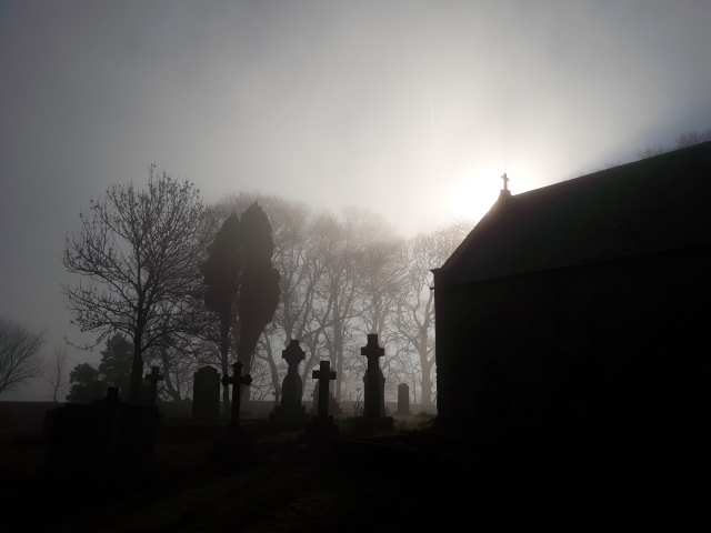
St Oswald’s Church, Heavenfield, in the morning mist (c) Duncan Hutt

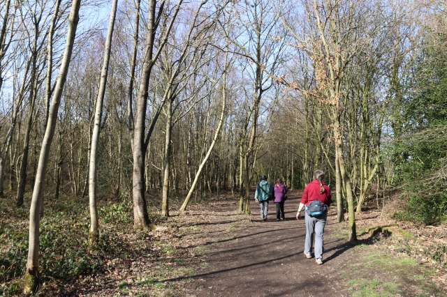
The fog was beginning to clear as we set out past St Oswald’s Church at the appropriately named Heavenfield.  The walk took us along part of the Hadrian’s Wall trail but the wall itself was largely an irrelevance.

The mist swirled around the church giving glimpses of the sun, the promise was for a warm and bright day, more appropriate for much later in the year than a February morning.  The church itself is small, perched on the hill top but tucked into its surrounding churchyard trees.  It’s on the site of a AD 635 battle between King Oswald of Northumbria and King Cadwollon of Gwynedd.  King Oswald became a saint and the church is dedicated to him.

P1030065 sml

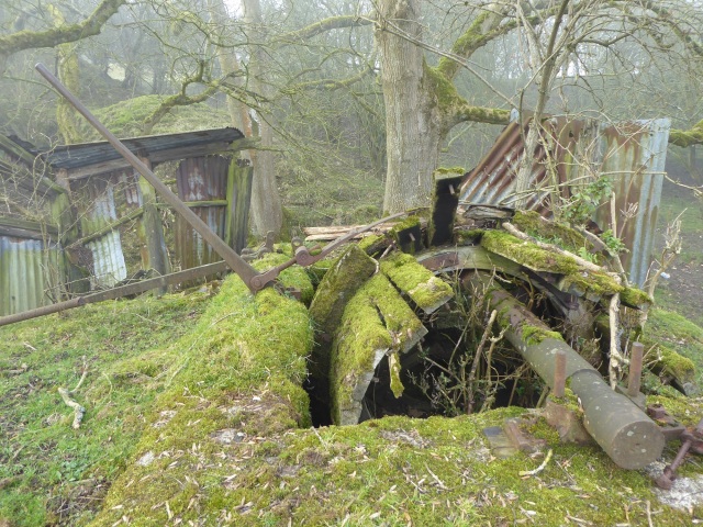
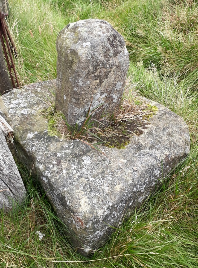
Winch drum for tramway incline at Cocklaw Quarry (c) Sally Hutt

OLYMPUS DIGITAL CAMERA

Winch drum, Cocklaw Quarry (c) Duncan Hutt

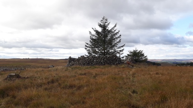
There was a chill in the air as we descended back into the fog down the path behind the church and into the seeming unknown.  Part way down the hill the path skirts the side of Cocklaw Quarry, following an old tramway incline as it drops past the void to the left.  At the base of this top incline is the top of the lower one.  Here a set of corrugated iron sheds is slowly disintegrating and in front of them is the remarkably intact winch drum.  This is the drum on which the cable would be wound so that laden trucks descending could be used to haul up the empty ones; a brake mechanism allowed for some control from the top.

20190224_203907.jpg

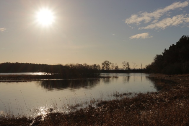
Sun through the mist at Cocklaw (c) Duncan Hutt

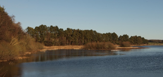
Further on and the sun eventually burnt through providing views north to Chollerton and the North Tyne.  Ahead was the old windmill tower of Chollerton Farm which would have provided a then modern way to drive machinery when the farmstead was constructed.  On our side of the valley, at Cocklaw is an older piece of history, a defensive pele tower from the days of border reiving.

P1030088 Cocklaw tower

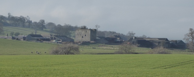
The peel tower at Cocklaw (c) Sally Hutt

OLYMPUS DIGITAL CAMERA

Old lane to Keepwick Fell (c) Duncan Hutt

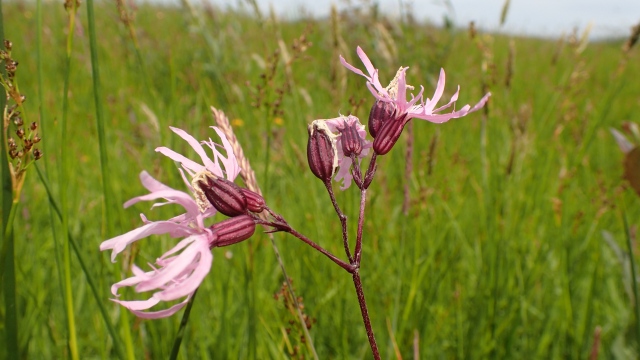
We took an old trackway back up the hill past Keepwick Fell.  The old route never quite became a proper road, its value gone before any upgrade would have occurred.  A pleasant green lane hemmed between hedges until opening out onto hill ground above.  Here skylarks sang in the now blue sky above and a pair of curlew piped their warbling call to the east.  A line of small limestone quarries could be traced across the hillside, ones that never quite became the size and complexity of Cocklaw.

The walk back was along the line of Hadrian’s Wall, or at least the defensive ditch to its north side, the wall being lost under the nearby road.  But, there wasn’t much of the Roman history to see and the stories in the landscape of more modern times was a far more fascinating tale to be read.

P1030092 quarries

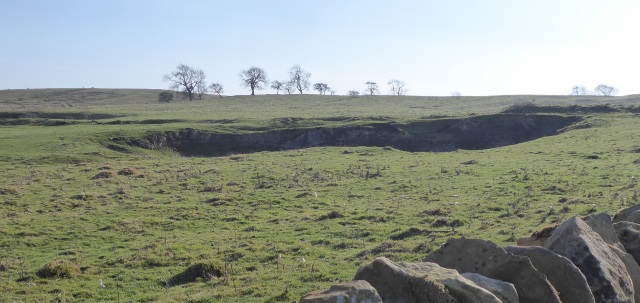
Limestone quarries, Keepwick fell (c) Sally Hutt

Posted in Archaeology, Birds, Northumberland | Tagged , , , , , , , , , | Leave a comment

A wood on the border

IMG_7185

Entering Philipshill Wood (c) Duncan Hutt

20190217_114742.jpgPhilipshill Wood is situated right on the border of Buckinghamshire and we approached from neighbouring Hertfordshire.  It’s a very different sort of wood from those we are more used to in Northumberland, a plantation broadleaved woodland with ranks of beech in some areas, pine and other species elsewhere.  Tall straight trees letting in some light to the woodland floor in these leafless winter months.

In some areas bluebells carpet the ground but at this stage it’s a swathe of leaves with no sign of the flowers to come later in spring.  The other notable plants were also still invisible; winter still has a hold even though the sun that flickered through the trees had a modicum of warmth.IMG_7199

IMG_7195

Ranks of Beech (c) Duncan Hutt

Posted in Flowering Plants | Tagged , , , , | 2 Comments

Hallington Reservoirs

img_7129 sml pan

Frozen corner of Hallington reservoir

Tucked away near the small village of Colwell these reservoirs had been far from my list of destinations to visit in Northumberland.  About two years ago I finally found my way cross country to this quiet part of a quiet county.  Today’s wintry, clear skies provided a crisp and clear view of these lakes, the browned vegetation around the margins taking on a golden hue in the afternoon light.

img_7107 sml

Fishing boat on Hallington Reservoir

These reservoirs were one of a series of such structures linking the hills of Northumberland at Catcleugh to Newcastle’s water supply at Whittle Dene.  There is a complex series of pipes and aqueducts linking them all with Colt Crag and Hallington weirdly placed amongst rolling hills with dams at multiple places around the water’s edge.  Hallington Reservoirs are actually two on differing levels split by a central dam.  Today’s walk circumnavigated the western of the two.

img_7112 sml

Bridge date and company logo, Hallington Reservoir

The green iron bridge that carries you over the western spillway has a date and intertwined company initials at its centre.  1889, NGWW.  The Newcastle and Gateshead Waterworks later became the Newcastle and Gateshead Water Company.  Now it’s run by Northumbrian Water.

It was a relatively quiet day in terms of wildlife.  A few cormorants fished the eastern section while a golden-eye repeatedly disappeared into a dive.  Tree sparrows fed on some feeders at the fishing club along with blue and great tits.  A small flock of unidentified gulls stood incongruously on the lingering ice at a sheltered corner while long tailed tits twittered through willows at the water’s edge.

img_7137 small

Afternoon sun at Hallington Reservoir

Posted in Birds, Northumberland | Tagged , , , | 3 Comments

Old Lanes

Occasionally you come across an old lane that has never quite become a modern road.  Most of these routes have a story to tell, some historical reason that has ceased to be important in the modern world.  A wonderful maze of these old routes occurs in the bocage of Normandy but elsewhere near abandoned routes occur for a whole range of reasons.

20190106_113556.jpg

Mill Lane near Stamfordham (c) Duncan Hutt

Near Stamfordham, in Northumberland, is Mill Lane, one of these roads that exists but is rarely used, with an ‘unsuitable for motors’ sign marking the point the asphalt ends.  The lanes original purpose is shown in its name.  This was the route from the small farming hamlet of Heugh down to Heugh Mill.  The corn mill has long closed and the local focal point became the village of Stamfordham.  The number of people wanting to utilise Mill Lane must have dwindled and it was never properly surfaced.

Now it’s a peaceful countryside route, in summer the lane can be buzzing with hoverflies and in early winter the hedges and trees provide a food corridor for visiting fieldfares and redwings.  Today all was quiet, a bluetit and wren dived for cover in the hawthorn bushes to the edge but little else stirred.

Posted in Archaeology, Northumberland | Tagged , , | 1 Comment